Tropical Storm Erin has recently formed in the eastern Atlantic. In this Tropical storm erin update, we will explain what’s happening in a simple way so everyone can understand. We’ll look at where the storm is right now, how it might grow, and if it could affect land.
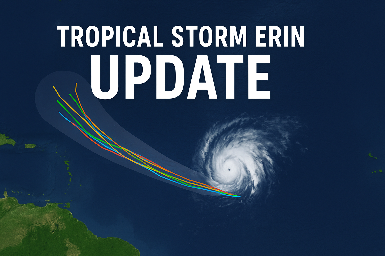
Tropical storm erin spaghetti models
Meteorologists use special maps called spaghetti models to predict storm paths. Each line on the map shows one possible route the storm could take. For Tropical Storm Erin, most spaghetti models show it staying in open water and slowly turning north. This means it might not hit land directly. However, storms can change direction, so experts will keep monitoring it closely.

Hurricane erin spaghetti models noaa
The NOAA (National Oceanic and Atmospheric Administration) also uses spaghetti models for forecasting. Their predictions suggest that if Erin strengthens quickly into a hurricane, it is more likely to turn north and stay over the ocean. If it grows more slowly, the storm might move farther west before turning, which could bring it closer to islands or coastlines. This difference in timing is why updates are so important.
where is hurricane erin going to hit
Right now, Tropical Storm Erin is not expected to make landfall. Forecasts say it will probably stay north of the Caribbean and curve into the open Atlantic. But weather is unpredictable. Even small changes in wind patterns, high-pressure systems like the Bermuda High, or ocean temperatures could push Erin in a new direction. That’s why coastal communities still need to stay alert until the path is certain.
ALSO READ: 6 Game-Changing Features of the Google DeepMind Impact Accelerator
Latest on tropical storm erin
Here’s the latest on tropical storm erin as of mid-August 2025:
- Formation & Location: Erin formed on August 11 in the eastern Atlantic, about 280–750 miles west of the Cabo Verde Islands. It is moving west at about 20–22 mph, with sustained winds near 45 mph.
- Impact on Cabo Verde: Before it became a named storm, Erin brought heavy rain to the Cabo Verde Islands. The flooding caused damage and led to several deaths. The government there has declared a disaster in the affected areas.
- Expected Strengthening: Forecasters expect Erin to become the first hurricane of the 2025 Atlantic season within the next day or two. By the weekend, it might even reach major hurricane status (Category 3) as it moves over warmer ocean waters.
- Possible Path: Many forecast models agree Erin will turn north before reaching the Caribbean, possibly passing north of Puerto Rico, the Bahamas, and the U.S. East Coast. If it stays weaker for longer, it might track farther west before turning.
- Uncertainties: The exact path depends on large weather systems and ocean conditions. Areas like Bermuda or even eastern Canada could be affected if the storm turns later than expected. Meteorologists will continue to watch Erin closely for changes.
How forecasters track storms
Storm prediction combines science, technology, and experience. Here’s how experts keep track of Erin’s movements:
- Satellites take detailed images of clouds and measure temperatures.
- Aircraft reconnaissance—special planes fly into storms to measure wind speed, air pressure, and temperature.
- Computer models simulate possible storm paths based on weather data.
- Buoys and ships in the ocean collect real-time information about waves, currents, and air pressure.
This data helps meteorologists update forecasts and warn people if a storm’s path changes.
ALSO READ: Tropical Storm Dexter Hurricane – Everything You Should Know
Why storms like Erin can change suddenly
Tropical storms and hurricanes are powered by warm ocean water. If a storm moves over warmer areas, it can quickly become stronger. On the other hand, if it encounters cooler water, dry air, or strong winds in the upper atmosphere, it may weaken.
Erin’s future path and strength will depend on:
- Sea surface temperatures – warmer water gives the storm more energy.
- Wind shear – strong winds high in the atmosphere can tear storms apart.
- High-pressure systems – these can steer storms in new directions.
Because these conditions change constantly, forecasts are always updated.
Safety tips during hurricane season
Even though Erin is not currently expected to hit land, it’s important to know what to do during hurricane season:
- Stay informed – follow official weather updates from trusted sources.
- Have an emergency kit – include food, water, medicines, and a flashlight.
- Plan evacuation routes – know where to go if you must leave home quickly.
- Protect your home – secure windows and bring loose outdoor items inside.
Preparation is always better than waiting until the last moment.
Looking ahead
Tropical Storm Erin is a reminder that the Atlantic hurricane season can be unpredictable. The storm might stay over open water, or changes in weather patterns could bring it closer to land. Meteorologists expect Erin to be a long-lived system, possibly lasting for more than a week as it travels through the Atlantic.
Summary
- Tropical storm erin update: Erin formed in the eastern Atlantic and is moving west.
- Spaghetti models: Most suggest a northward turn before landfall.
- NOAA forecast: A quick-strengthening storm is more likely to stay at sea.
- Current impact: Cabo Verde saw flooding and damage before Erin became a named storm.
- Future: Could become a major hurricane, but path remains uncertain.